Mingo Falls Cherokee NC rises quietly from the forested hills of Cherokee, North Carolina, yet it leaves a loud impression.
Tucked just outside Great Smoky Mountains National Park on the Qualla Boundary, this towering Mingo Falls waterfall drops about 120 feet down a rugged rock face.
It’s often called one of the tallest and most beautiful waterfalls in the region, and once you see it, you’ll understand why.
Set in the heart of the Smoky Mountains, Mingo Falls, NC, feels both accessible and wild. The short but steep climb adds a bit of effort, which makes the view even sweeter.
Planning a visit? This guide walks you through directions to Mingo Falls, trail details, timing tips, and what to expect so your trip feels easy, not rushed.
What Is Mingo Falls in Cherokee, North Carolina?
If you’re searching for a waterfall that delivers a big impact with a short hike, Mingo Falls, NC, is it. Located just outside Cherokee, this towering cascade is one of the tallest waterfalls in the southern Smoky Mountains.
It’s close to town, yet once you’re there, it feels quiet and tucked away. Here’s the thing. The trail is short. The climb is steep. And the view? Worth every step.
Why Mingo Falls Cherokee NC Is One of the Tallest Waterfalls in the Smoky Mountains
- One of the tallest waterfalls in the Smoky Mountains, with an impressive vertical drop that towers over many nearby falls
- Measured at approximately 120 feet tall, making it a standout among Smoky Mountain waterfalls
- Features a single, dramatic plunge, which adds to the perception of height compared to tiered waterfalls
- Located in a steep mountain gorge, enhancing its sheer and imposing appearance
- Fed by year-round mountain runoff, keeping the waterfall powerful and visually striking
- Often compared with other Smoky Mountain waterfalls, but consistently ranks among the tallest waterfalls that Smoky Mountains visitors can easily access
Mingo Falls Cherokee NC Waterfall Height, Scenery, and Viewing Area
Mingo Falls is widely recognized as one of the tallest in the region.
Key Facts About Mingo Falls
| Feature | Details |
| Estimated Height | Approx. 120 feet, sometimes cited up to 150 to 200 feet |
| Location | Eastern Cherokee Reservation, Cherokee, NC 28719, United States |
| Setting | Forested cove in the Smoky Mountains |
| Viewing Area | Wooden bridge near the base |
History and Cultural Significance of Mingo Falls
Now let’s talk about where it stands.
Mingo Falls, Cherokee, North Carolina, is located on the Qualla Boundary, land held in trust for the Eastern Band of Cherokee Indians. This is not just public forest land. It is a culturally significant territory.
Cultural Context
| Element | Significance |
| Qualla Boundary | Tribal land of the Eastern Band of Cherokee Indians |
| Alternate Name | Big Bear Falls |
| Symbolism | Bears represent strength and protection in Cherokee culture |
The name “Big Bear Falls” connects to Cherokee tradition, where bears hold spiritual importance. Over time, the name Mingo became commonly used, but the deeper cultural roots remain.
Where Is Mingo Falls Located?

Before you lace up your shoes, it helps to know exactly where you’re headed. Mingo Falls, Cherokee, North Carolina, sits just outside the main town of Cherokee, tucked along Big Cove Road.
It feels remote, but it’s surprisingly close to major Smoky Mountains routes.
Let’s break it down clearly.
Exact Location of Mingo Falls Cherokee NC Trailhead
If you’re plugging it into Google Maps, use these coordinates for Mingo Falls, NC:
| Detail | Information |
| GPS Coordinates | 35.5109° N, 83.3057° W |
| Road Access | Big Cove Road |
| Nearest Landmark | 5 minutes from downtown Cherokee |
| Trailhead | Small roadside parking area on Big Cove Road |
The Mingo Falls trailhead is located off Big Cove Road, about 4 to 5 miles from the Oconaluftee Visitor Center in Great Smoky Mountains National Park.
It sits on the Qualla Boundary, not inside the national park itself. That surprises people, but it also means easy roadside access.
How Far Is Mingo Falls from Gatlinburg, TN?

Planning a Smoky Mountains day trip? Here’s what you need to know.
| Route | Distance | Drive Time |
| Gatlinburg, TN via US 441 South | Approx. 35 miles | 1 hour to 1 hour 15 minutes |
The drive from Gatlinburg crosses Newfound Gap Road through Great Smoky Mountains National Park. It’s scenic, especially in the fall when the foliage lights up the ridges.
Tips for day visitors:
- Start early to avoid park traffic
- Check the weather at higher elevations
- Fuel up before entering the park
Honestly, the drive itself feels like part of the adventure.
Nearby Towns: Cherokee, Bryson City And Asheville
Mingo Falls Cherokee NC is well-positioned for regional travel.
| Town | Distance To Mingo Falls |
| Cherokee Town Center | 5 miles |
| Bryson City NC | 15 miles |
| Asheville NC | 60 miles |
Because it’s so close to Cherokee, you can pair the Mingo Falls Cherokee NC waterfall hike with:
- Harrah’s Cherokee Casino
- Oconaluftee Visitor Center
- Blue Ridge Parkway access near Asheville
It’s short. It’s accessible. And it fits easily into a Smoky Mountains itinerary without taking over your entire day. That’s what makes it such a smart stop.
Love the idea of a private mountain escape? Explore Cabin Rentals in NC: 7 Amazing Ultimate Picks 2026 for secluded, picture-perfect cabins near waterfalls and hiking trails.
How To Get To Mingo Falls Cherokee NC – Directions And Parking
Finding Mingo Falls, Cherokee, North Carolina, is simple once you know the turn. It sits just outside downtown Cherokee, but first-time visitors often miss it because the sign is small.
Here’s a clear, step-by-step breakdown so you don’t circle back twice.
Directions to Mingo Falls from Downtown Cherokee

If you are staying near the Oconaluftee Visitor Center or downtown Cherokee, you are only minutes away from the Mingo Falls Cherokee NC trailhead.
Directions To Mingo Falls Trailhead
- Start in downtown Cherokee near US Highway 441
- Turn onto Big Cove Road
- Drive approximately 4.5 miles
- Watch for the brown roadside sign for Mingo Falls
- Turn right into the small gravel parking area
Drive time is about 13 minutes.
Here’s the thing. The road narrows as you approach. Slow down. Locals use this road daily.
Parking Details
| Parking Area | Type | Notes |
| Main Mingo Falls Lot | Gravel roadside lot | Limited spaces, fills quickly in summer and fall |
| Shoulder Overflow | Informal roadside parking | Only when lot is full, park carefully |
There is no fee to park. No large visitor center. No gift shop. It’s simple and rustic.
Map tip: Search “Mingo Falls Trailhead” in Google Maps. Do not stop at Mingo Falls Campground unless you plan to camp. They are separate locations.
Directions to Mingo Falls from Bryson City and Asheville
Coming from farther out? Let’s break it down.
From Bryson City

- Distance: Approx. 15 miles
- Drive Time: 25 to 31 minutes
- Route: Take US 19 North toward Cherokee, then turn right onto Big Cove Road
It’s a scenic drive along the Oconaluftee River. In the fall, the foliage along US 19 is striking. In spring, the river runs strong after rain.
From Asheville

- Distance: Approx. 60 miles
- Drive Time: 1 hour 19 minutes
- Route: Take I-40 West to Exit 27, then US 74 West toward Cherokee, merge onto US 441 North, then Big Cove Road
Many visitors combine Mingo Falls and the Smoky Mountains with a drive through the Blue Ridge Parkway. If you enjoy winding mountain roads, this stretch delivers.
Quick reference table:
| Starting Point | Approx. Distance | Avg. Drive Time |
| Downtown Cherokee | 4.5 miles | 13 minutes |
| Bryson City | 15 miles | 25 to 31 minutes |
| Asheville | 60 miles | 1 hour 19 minutes |
No shuttle services operate to Mingo Falls, NC, so personal vehicle access is required. Arrive early during peak season. Parking is small, and it fills fast.
Mingo Falls Hike: Trail Details and Difficulty
The Mingo Falls hike is short in distance but surprisingly demanding. Many visitors assume it is an easy stroll because it is less than half a mile. That is partly true. It is short. But it is not flat.
Let us walk you through what to expect so there are no surprises when you reach the Mingo Falls trailhead.
Mingo Falls Trailhead and Pigeon Creek Trail Overview

The hike to Mingo Falls, Cherokee, North Carolina, begins at a clearly marked Mingo Falls trailhead off Big Cove Road. A small parking area sits at the base of the stairs.
Mingo Falls Trail Facts
| Feature | Details |
| Trail Name | Pigeon Creek Trail |
| Round Trip Distance | Approx. 0.3 to 0.4 miles |
| Elevation Gain | Around 150 to 200 feet |
| Trail Type | Out and back |
| Surface | Wooden steps, dirt path, roots, rocks |
The first section includes a long staircase that climbs steadily uphill. After the stairs, the trail transitions to a compact dirt path with exposed roots and uneven terrain.
How Long Is the Hike to Mingo Falls?
So, how long is the hike to Mingo Falls Cherokee NC really?
Most visitors reach the base in:
- 10 to 15 minutes if walking steadily
- 20 to 30 minutes if stopping for breaks or photos
Coming down is faster, usually under 10 minutes.
Now, here is the part people underestimate. The distance is short, but the climb feels steeper than expected. Why?
- Approximately 160 wooden steps at the beginning
- Continuous uphill grade
- No flat resting platform until near the top
Those stairs are sturdy but steep. They climb quickly. It feels like climbing several flights of outdoor stairs in one stretch.
If you pace yourself, it is manageable. If you rush, you will feel it in your legs.
Mingo Falls Cherokee NC Difficulty And What To Expect
The Mingo Falls trail is generally rated moderate. Not because of length. Because of incline.
Let’s break it down clearly.
Why It Is Considered Moderate
- Steep stair section at the start
- Steady elevation gain in a short distance
- Uneven dirt path with roots and rocks
- Slippery surfaces after rainfall
After rain, the trail can become slick. Wet leaves and damp wooden steps require attention. During fall, leaf cover may hide roots and rocks. In winter, icy patches can form on stairs.
Trail Highlights And Viewing Areas
Once you finish the climb, the reward is immediate. The trail opens to a wooden viewing bridge at the base of Mingo Falls.
Main Viewing Area
| Feature | Description |
| Viewing Platform | Wooden bridge facing the falls |
| Distance From Falls | Close enough to feel mist after heavy rain |
| Accessibility | Direct access from trail end |
The bridge provides a safe and stable vantage point for photos. From here, you can capture the full vertical drop framed by the forest.
Want better angles? There are a few informal spots along the rocks near the base. Use caution. Rocks can be slick, especially after rainfall.
Scenic Highlights Along The Trail
- Small creek crossings below the falls
- Moss-covered boulders
- Dense hardwood canopy
- Seasonal wildflowers in spring
Photographers often visit in early morning when light filters through trees at an angle. In autumn, fall foliage adds layers of red and gold around the waterfall. Winter can reveal partial ice formations along the rock face.
Best Time to Visit Mingo Falls Cherokee NC
Planning your visit to Mingo Falls, NC, is simple, but timing can shape your whole experience. The waterfall changes with the seasons. Light shifts. Water levels rise and fall.
Crowds come and go. Let us break it down clearly so you know what to expect.
Seasonal Breakdown
Each season gives Mingo Falls Smoky Mountains a different personality. Same waterfall. Different mood.
Mingo Falls by Season: What to Expect Year-Round
Daily Timing Tips
Season matters. But so does time of day.
Best Time Of Day
- Early morning, before 10 AM
- Weekdays during peak travel months
- Shortly after sunrise for softer light
Morning light hits the falls more evenly, reducing harsh shadows. Parking at the Mingo Falls Cherokee NC trailhead is limited, so arriving early helps.
Avoiding Crowds
- Avoid mid-afternoon, especially on weekends
- Expect higher traffic during the October foliage season
- Summer afternoons see a steady tourist flow from Cherokee
Honestly, if you want calm and fewer people on the viewing bridge, go early. The waterfall feels more personal then. Quieter. More immersive. And that makes all the difference.
Turning this into a Smoky Mountains getaway? Don’t miss our Best Places to Stay at Smoky Mountains 2026 Guide to find scenic lodges, cozy cabins, and family-friendly options.
Nearby Waterfalls and Outdoor Activities in Cherokee
Once you’ve visited Mingo Falls, Cherokee, North Carolina, you might think the highlight is over. It isn’t. Cherokee sits at the doorstep of the Great Smoky Mountains, and the outdoor options stack up quickly.
Waterfalls, mountain drives, deep forest hikes, and river walks. It’s all within minutes. Let’s break it down clearly.
Upper And Lower Mingo Falls Areas
Most visitors experience the main Mingo Falls waterfall from the wooden bridge at the base. That is the developed viewing area accessed from the Mingo Falls Cherokee NC trailhead.
There is:
- The main staircase trail to the base
- A creekside area below the bridge
- Informal paths near the stream
There is no officially maintained “Upper Mingo Falls” trail open to the public. The established route remains the primary and safest access point.
Straying off the trail is discouraged due to steep terrain and tribal land protections.
Soco Falls Near Cherokee NC
About 15 minutes east along US 19 toward Maggie Valley sits Soco Falls. It’s smaller than Mingo Falls Cherokee NC but visually unique.
Key facts:
| Feature | Soco Falls |
| Distance From Cherokee | Approx. 5 to 6 miles |
| Height | Around 50 feet |
| Trail Length | Short but steep path |
| Type | Double waterfall |
Two streams merge into one basin. It’s dramatic, especially after rain. The pull-off parking is limited, so timing matters.
Hiking Trails and Scenic Drives Near Mingo Falls
Cherokee borders the southern entrance of the Great Smoky Mountains National Park. That opens up serious hiking options:
- Oconaluftee River Trail
- Deep Creek Trails
- Clingmans Dome Observation Tower
- Mingus Mill area
- Blue Ridge Parkway overlooks
You also have:
- Tubing on the Oconaluftee River
- Fishing for trout
- Elk viewing in Cataloochee Valley
- Scenic drives through Newfound Gap Road
So yes, Mingo Falls in the Smoky Mountains is impressive. But it’s only the beginning. One waterfall turns into a full outdoor weekend before you know it.
Where to Stay Near Mingo Falls Cherokee NC
After hiking Mingo Falls in Cherokee, North Carolina, most visitors ask the same question. Where should we stay?
The good news is this area offers everything from simple camping near the trailhead to fully furnished mountain cabins.
Let’s break them down clearly.
Camping Near Mingo Falls Trailhead
If you want to stay close to the Mingo Falls trailhead, camping is the most direct option.
While there is no large commercial campground directly at the waterfall, camping is available in the greater Cherokee area, including tribal campgrounds and nearby Great Smoky Mountains National Park sites.
Typical Camping Amenities Near Mingo Falls, NC
- Tent sites and RV hookups
- Restrooms and shower facilities at select locations
- Picnic tables and fire rings
- Easy road access to Big Cove Road
Most campgrounds are within a 10 to 20 minute drive from Mingo Falls, Cherokee. During peak fall foliage and summer weekends, reservations fill quickly.
Spring is quieter and ideal if you prefer fewer crowds and stronger waterfall flow.
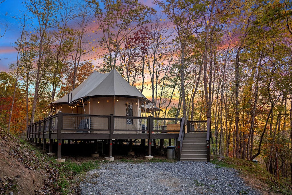
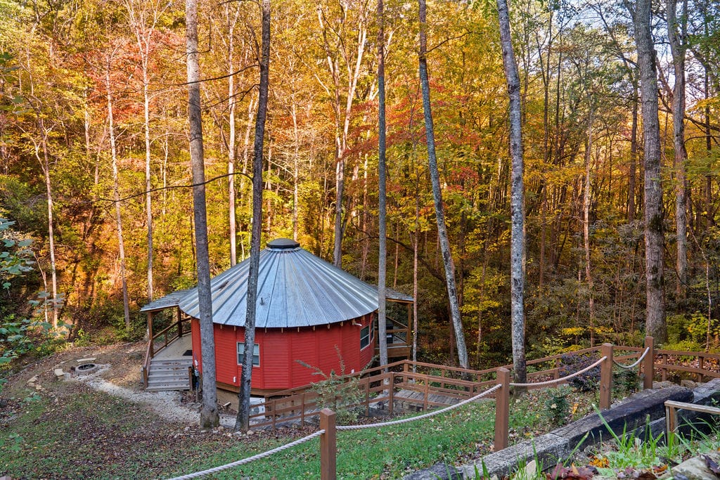
Best Cabin Rentals Near Mingo Falls
If camping is not your style, no problem. Cherokee and surrounding mountain communities offer cabin resorts that combine comfort with proximity to Mingo Falls Cherokee NC, a waterfall.
Below are reliable options.
1. Elk Hollow Resort

Located in the Smoky Mountain region near Cherokee, Elk Hollow Resort offers fully equipped cabin rentals surrounded by forested hills.
It serves as a convenient base for visiting Mingo Falls, NC, the Oconaluftee Visitor Center, and the Blue Ridge Parkway scenic drives.
Key features:
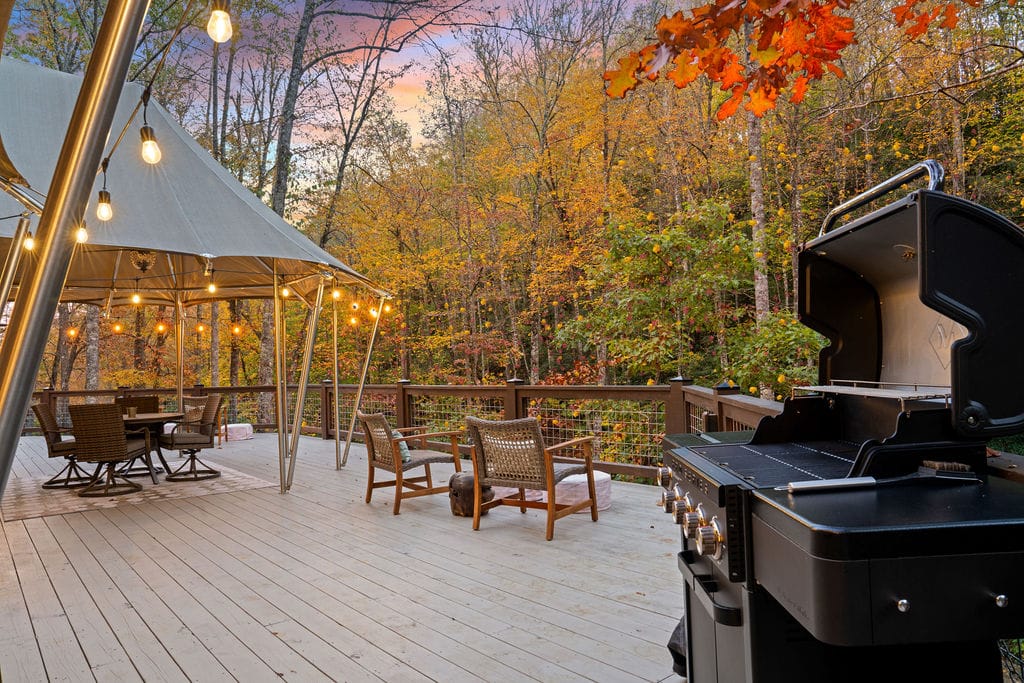
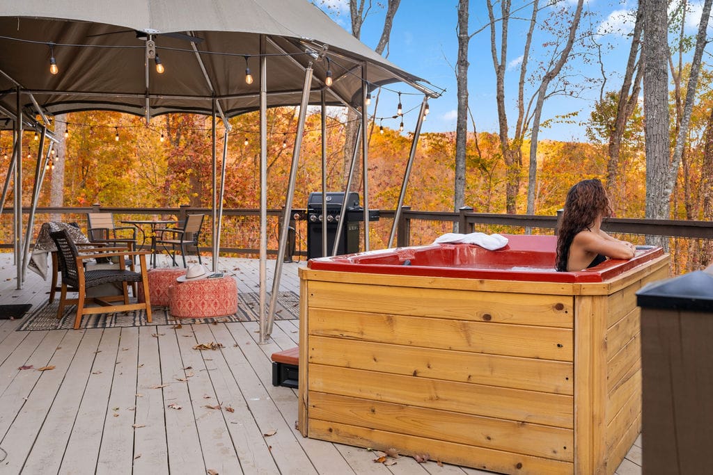
- Private cabins with kitchens
- Hot tubs in select units
- Family-friendly layout options
- Easy access to outdoor attractions
The setting feels quiet but not isolated. After climbing the 160-plus steps at Mingo Falls Cherokee NC trail, coming back to a private deck overlooking the mountains feels earned.
2. Bluebird Cabins

Bluebird Cabins provide rustic-style lodging close to downtown Cherokee. These cabins are ideal for couples and small families visiting Mingo Falls, Cherokee, North Carolina.
Highlights include:
- Fully furnished interiors
- Covered porches
- Close driving distance to restaurants and Harrah’s Cherokee Casino
They balance convenience with mountain charm. You’re close to town, yet surrounded by trees. That contrast works well for short waterfall trips.
3. Watershed Cabins

Watershed Cabins sit along Soco Creek, offering creekside lodging near Cherokee. If you plan to explore multiple waterfalls, including Mingo Falls in the Smoky Mountains, this is a practical base.
Property features:
- Cabin rentals with multiple bedroom sizes
- Outdoor fire pits
- Creek access for relaxing evenings
Location matters. Watershed Cabins are within easy reach of Big Cove Road, making early morning visits to the Mingo Falls trailhead simple and crowd free.
4. Panther Creek Cabins

Panther Creek Cabins offer elevated mountain views and private accommodations outside central Cherokee. These cabins suit travelers seeking more seclusion after busy daytime hikes.
Amenities typically include:
- Mountain view decks
- Fully equipped kitchens
- Comfortable living spaces
Driving time to Mingo Falls, Cherokee, remains manageable, usually under 20 minutes depending on exact location. You get space, quiet, and a solid home base for Smoky Mountain adventures.
5. Cherokee Mountain Cabins

Cherokee Mountain Cabins provide a mix of rustic charm and modern comfort near the Cherokee town center. They work well for families exploring Mingo Falls, NC, and nearby attractions.
Key features:
- One to three bedroom cabins
- Porch seating areas
- Convenient highway access
If you plan to combine waterfall hiking with cultural sites on the Qualla Boundary, staying here keeps travel simple.
Planning to stay nearby? Check out our Top Bryson City NC Accommodations 2026 Guide – Stunning Stays for handpicked stays that blend comfort with mountain charm.
Final Thoughts: Beneath The Falling Water
A visit to Mingo Falls, NC, is short, powerful, and memorable. But protecting it matters just as much as seeing it. Follow Leave No Trace principles.
Carry out all trash. Stay on the marked Mingo Falls Cherokee NC, trail and avoid climbing on fragile rocks near the base of the waterfall.
Wildlife lives here year-round. Black bears, small mammals, and insects share this forest. Keep food secured and use insect repellent during warmer months.
Bring water, even though the hike is brief. Wear sturdy shoes for the steep steps near the Mingo Falls trailhead. A little preparation keeps your Smoky Mountains adventure safe and respectful.
FAQs | Mingo Falls Cherokee NC
1. Where Is Mingo Falls In Cherokee?
Mingo Falls, Cherokee, North Carolina, is located off Big Cove Road, about 5 miles from downtown Cherokee on the Qualla Boundary. The Mingo Falls trailhead sits just past the Oconaluftee Visitor Center area in the Smoky Mountains.
2. How Long Is The Hike To Mingo Falls?
The hike to Mingo Falls waterfall is about 0.4 miles round trip. Most visitors complete it in 20 to 30 minutes, though the 160 plus steps make it feel steeper than the distance suggests.
3. What Is The Most Beautiful Waterfall In The Smoky Mountains?
Beauty is subjective, but many consider Mingo Falls in the Smoky Mountains one of the most dramatic due to its 120 foot vertical drop. Others often mention Ramsey Cascades and Laurel Falls for their scenic appeal.
4. What Are The Top 5 Waterfalls In The Smoky Mountains?
Popular picks include Mingo Falls, Ramsey Cascades, Laurel Falls, Grotto Falls, and Abrams Falls. Each offers a different hiking experience, from short paved walks to longer backcountry treks.
5. What Is The Highest Waterfall In The Smoky Mountains?
Ramsey Cascades is the tallest waterfall fully inside Great Smoky Mountains National Park at about 100 feet. However, Mingo Falls, NC, is taller overall at roughly 120 feet and is located just outside park boundaries.
6. How Long Does The Four Waterfalls Walk Take?
The popular Four Waterfalls Loop in the Smokies region typically takes 2 to 4 hours depending on pace and trail conditions. Time varies based on distance, elevation gain, and stops for photos.
7. Can You Drink Water From A Waterfall?
No, it is not safe to drink untreated waterfall water. Even clear mountain water near Mingo Falls, Cherokee, can contain bacteria or parasites, so always filter or boil before drinking.
8. What Is The Prettiest Part Of The Smoky Mountains?
Many visitors love Cades Cove for wildlife and open valleys, while others prefer the high elevations of Clingmans Dome. Areas around Mingo Falls, Cherokee, North Carolina, also rank high for lush forest scenery.
9. What Is The Most Amazing Waterfall In The US?
Niagara Falls is often considered the most powerful and iconic in the United States. For height and mountain scenery, Yosemite Falls in California frequently tops national lists.
10. What Is A Golden Waterfall?
A golden waterfall refers to a waterfall that appears golden due to sunlight reflection, mineral content, or seasonal lighting. The effect is visual, not a different type of waterfall formation.