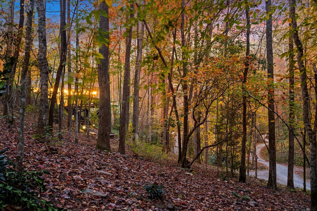
Bryson City has a way of surprising people. It doesn’t advertise itself loudly, yet somehow the waterfalls here feel close, accessible, and woven into everyday life rather than hidden behind complicated plans.
Morning mist rolls off the Bryson City mountains, rivers catch the light just right, and within a short drive, you’ll find waterfalls tucked into forests, roadside pull-offs, and gentle trails that don’t demand an all-day commitment.
If you’ve ever searched for waterfalls near Bryson City and assumed it meant long hikes or confusing trail logistics, this guide is meant to reset that expectation. These are easy-to-moderate waterfall trips that fit naturally into a day, whether you’re visiting for a weekend, traveling with family, or simply want a scenic break without overthinking the route.
There’s no Deep Creek loop here and no repeats from your last trip. Just realistic day trips, clear driving expectations, and honest advice on when to go, what to pack, and where to slow down long enough to enjoy the view.
Waterfalls Near Bryson City: Quick Overview & Day-Trip Planning
Before diving into each waterfall, it helps to understand how they’re spread out geographically. Bryson City sits between the Great Smoky Mountains and the Pisgah / Blue Ridge Parkway region, which means some waterfalls are very close, while others are worth a slightly longer drive for a different experience.
Think of this section as your planning shortcut a quick way to decide whether you want:
- One easy waterfall close to town
- A relaxed half-day outing
- Or a full scenic day with multiple stops
How to use this guide
- Short on time? Choose waterfalls within the Fontana or Deep Creek areas.
- Chasing photos? Head toward Pisgah and the Blue Ridge Parkway for variety and scale.
- Traveling with kids or first-time hikers? Focus on roadside or short-trail waterfalls first.
Quick tip: Pair one “easy-access” waterfall with one short hike for the best balance of effort and reward
Quick geography note: Bryson City sits between the Smokies (TN/NC) and Pisgah/Blue Ridge Parkway (NC). Some waterfalls here are close (Fontana area), while others are worth the drive (Pisgah/DuPont).
The table below breaks everything down by drive time, hike length, difficulty, and best season, so you can mix and match stops without turning the day into an expedition.
Tip: If you want minimal driving, choose 1 Smokies waterfall + 1 Fontana-area waterfall in the same day.
| Waterfall | Area / Nearest Town | Drive time from Bryson City (approx) | Hike length (round-trip) | Difficulty | Best season |
| Abrams Falls | Cades Cove (Great Smoky Mountains, TN) | ~1–1.5 hr | 5.0 mi RT | Moderate | Spring–Fall |
| Looking Glass Falls | Pisgah Nat’l Forest / Brevard | ~1.25–1.75 hr | Roadside / short walk | Very easy | Year-round (icy in winter caution) |
| Moore Cove Falls | Pisgah (near Brevard) | ~1.5–2.0 hr | ~0.7–1.2 mi RT | Easy | Spring–Fall |
| Graveyard Fields (Lower & Upper Falls) | Blue Ridge Parkway (Pisgah) | ~1.5–2.0 hr | 1–3 mi loop options | Easy–Moderate | Summer–Fall |
| Catawba Falls | Old Fort area (McDowell Co.) | ~2.0–2.5 hr | ~3.5 mi loop | Easy–Moderate | Spring–Fall |
| DuPont State Forest (Hooker / Triple / High Falls) | DuPont (Asheville area) | ~2–2.5 hr | 3–5 mi loop | Easy–Moderate | Spring–Fall |
| Bird Creek Falls / Bear Creek Falls | Fontana area | ~20–40 min (Fontana) to ~1 hr | Varies (short viewpoint to multi-mile) | Easy–Strenuous | Spring–Fall |
Quick links
Why this planning approach works
Instead of chasing distance or trying to see everything at once, this guide is built around flow — less backtracking, fewer rushed moments, and more time actually standing near the water.
By the time you reach the detailed waterfall descriptions below, you’ll already know:
- Which stops fit your energy level
- How much driving to expect
- When crowds are most likely (and how to avoid them)
From here, you can scroll straight to the waterfalls that match your day — or follow one of the ready-made itineraries further down the page.
Best 1-Day Waterfalls Itinerary (Low Driving)
If you’d rather spend your day enjoying waterfalls instead of sitting behind the wheel, this route keeps driving minimal while still delivering variety. It’s ideal for families, relaxed travelers, or anyone visiting Bryson City for the first time.
Morning: Bird Creek Falls & Bear Creek Falls (Fontana Area)
Start your day in the Fontana Lake area, just outside Bryson City. These waterfalls are some of the closest options to town, which means less planning and more time on the trail.
- Bird Creek Falls is a great warm-up: short, scenic, and peaceful in the early hours.
- If you’re feeling energetic, extend the hike toward Bear Creek Falls, which rewards effort with deeper forest scenery and fewer crowds.
Morning light filters nicely through the trees here, and the cooler temperatures make hiking comfortable even in warmer months.
Afternoon: Deep Creek Waterfalls (Juney Whank, Tom Branch & Indian Creek)
After lunch, head to Deep Creek, one of the most efficient waterfall areas near town.
This is where you can see multiple waterfalls in a short distance, making it perfect for a relaxed afternoon:
- Juney Whank Falls offers a dramatic footbridge view and is an easy favorite.
- Tom Branch Falls and Indian Creek Falls sit along the same trail, so there’s no backtracking.
If you’re linking internally, this is the natural place to reference your Juney Whank Falls guide — it fits seamlessly and adds depth without interrupting the flow.
Sunset: Return to Bryson City
Wrap up your day back in downtown Bryson City. Whether you grab an early dinner, stroll along the river, or simply head back to your stay to relax, this itinerary leaves you refreshed rather than exhausted.
This route works especially well if you’re staying nearby and want a full waterfall experience without overplanning.
Best 1-Day Waterfalls Itinerary (Most Photogenic)
If photography is your priority, this itinerary focuses on waterfalls that offer the best light, composition, and visual variety. It involves more driving, but every stop earns its place.
Early Morning: Looking Glass Falls
Begin early at Looking Glass Falls, one of the most iconic roadside waterfalls in western North Carolina.
- Morning light hits the falls cleanly before crowds arrive.
- The roadside access makes setup easy if you’re carrying camera gear.
- Even a quick stop here can produce standout images.
This is one of those rare waterfalls that looks impressive from almost every angle.
Midday: Moore Cove Falls
Next, head to Moore Cove Falls, a short, shaded hike that leads to a walk-behind waterfall.
This stop shines around midday:
- The forest canopy softens harsh light.
- You can shoot both from behind the falls and from the viewing platform.
- Wide-angle lenses work beautifully here.
It’s beginner-friendly, visually rewarding, and rarely feels rushed if timed right.
Late Afternoon: Graveyard Fields (Upper & Lower Falls)
Finish your day at Graveyard Fields, assuming Blue Ridge Parkway conditions are open and safe.
Late afternoon is ideal:
- Softer light enhances water texture and surrounding foliage.
- Seasonal color (especially in fall) adds depth and contrast.
- You can choose between the Upper Falls (shorter access) or extend to the Lower Falls if energy allows.
This is a fantastic place to slow down, experiment with long exposures, and end the day with some of the region’s most scenic views.
Which itinerary should you choose?
- Low Driving itinerary: Best for families, first-time visitors, and relaxed trips
- Most Photogenic itinerary: Best for photographers and travelers who don’t mind extra driving
Both routes pair beautifully with a stay near Bryson City, giving you flexibility to start early, return easily, and avoid the stress of overpacked days.
Best Time to Visit Waterfalls Near Bryson City
Let’s be honest: timing makes or breaks a waterfall visit. Show up early and the trail feels peaceful. Arrive late and you might spend more time circling for parking than actually walking.
When to visit
- Spring – Strong flows, flowers everywhere
- Summer – Warm weather for wading spots, though currents can surprise you
- Fall – Foliage that makes you reach for your camera without even thinking
- Winter – Roadside falls shine; some trails get icy and need extra care
Permits, Parking & Entry Fees for Bryson City Waterfalls
- Great Smoky Mountains National Park: a parking tag is required if you park longer than 15 minutes (daily/weekly/annual options).
- Blue Ridge Parkway: no entrance fee to drive/visit (camping may have fees).
- Looking Glass Falls (Pisgah NF): no fee site (parking is limited; don’t block the road).
- Some trailheads charge small fees
- Early arrival helps more than you expect
- Always double-check park websites; things change more often than you’d think
Refer for more info – https://www.nps.gov/grsm/planyourvisit/fees.htm
Note: Fees and access can change, double-check official park pages before you go.
Safety Tips for Visiting Waterfalls in Bryson City
- Heed swimming warnings, especially at Abrams
- Stay on marked trails so rescue teams don’t get surprise calls
- Watch weather for potential flash floods
- Leave no trace (simple rule, big difference)
- Good shoes matter more than fancy gear
Don’t miss this: Juney Whank Falls: A Hidden Gem Waterfall Near Bryson City
Top 7 Waterfalls Near Bryson City (Easy to Moderate Hikes)
Below you’ll find a more conversational walkthrough of each spot. Think of it as a friend explaining what to expect before you lace up your shoes.
1. Abrams Falls in Cades Cove (Great Smoky Mountains National Park)
Sometimes the trail to Abrams feels like a calm walk through a nature documentary.
Deer wander through the brush, and now and then, someone whispers about seeing a black bear. The path isn’t steep, but it keeps you moving enough to feel accomplished.
Abrams Falls Quick Facts:
- Trail Length: 5.0 miles round-trip
- Difficulty: Moderate
- Key Feature: Large-volume waterfall with deep pool at base (swimming discouraged)
- Location: Cades Cove, Great Smoky Mountains NP, TN
Abrams Falls Trail Description:
The route winds through forest with steady shade and a few gentle creek crossings. Families do fine here as long as the group can handle a longer walk. It’s one of those trails that almost tricks you into slowing down.
Abrams Falls Photo & Viewing Tips:
- Best light is early morning.
- Use a tripod for long exposure to capture the silky waterfall effect.
- The deep pool makes for dramatic compositions; foreground rocks add depth.
Abrams Falls Seasonality & Crowds:
- Spring: Full flows, vibrant greenery
- Summer: Crowds increase; mornings quieter
- Fall: Fall foliage provides a stunning backdrop
- Winter: Trail may be muddy; waterfall flow lower
Abrams Falls Safety Notes:
- Swimming prohibited; strong currents at base
- Watch footing on the rocky trail and near the pool
Abrams Falls Parking / Directions:
- Enter Cades Cove Loop from TN-32
- Trailhead parking near the Abrams Falls Trailhead stop
| Feature | Details |
| Trail Length | 5.0 mi RT |
| Difficulty | Moderate |
| Location | Cades Cove, Great Smoky Mountains NP, TN |
| Key Features | Large-volume waterfall, deep pool |
| Photo Tips | Early morning light, tripod, foreground rocks |
| Best Season | Spring–Fall |
| Crowds | Moderate; higher on weekends |
| Safety | Swimming prohibited, slippery rocks |
| Parking / Directions | Cades Cove Loop, Abrams Falls Trailhead |
Planning a full outdoor day? Pair this hike with one of the nearby trails from our Best Hikes Near Bryson City guide.
2. Looking Glass Falls (Easy Roadside Waterfall Near Bryson City)
This one is almost too easy in the best way. You pull up, take a few steps, and boom—there it is, tall and loud and photogenic from basically every angle.
Looking Glass Falls Quick Facts:
- Height: ~60–70 ft
- Access: Roadside, very easy
- Difficulty: Very easy
- Location: Pisgah National Forest, Brevard, NC
Looking Glass Falls Trail Description:
It’s the definition of a quick stop. Families love it, photographers camp out for angles, and honestly, even if you’re rushing between places, it’s worth pulling over for five minutes just to hear the water echo.
Looking Glass Falls Photo & Viewing Tips:
- Mid-morning light works best
- Include foreground rocks for scale
- Telephoto lens recommended for shots from safe distance
Looking Glass Falls Seasonality & Crowds:
- Year-round access; icy in winter
- Weekends are popular; arrive early to avoid parking congestion
Looking Glass Falls Safety Notes:
- Slippery rocks at base; avoid climbing
- Park only in designated areas
Looking Glass Falls Parking / Directions:
- Designated roadside parking along NC-276
- Easily accessible by car; pull-off lot adjacent to the falls
| Feature | Details |
| Height | ~60–70 ft |
| Difficulty | Very easy |
| Location | Pisgah National Forest, Brevard, NC |
| Access | Roadside, short walk |
| Photo Tips | Mid-morning light, foreground rocks, telephoto lens |
| Best Season | Year-round (icy winter caution) |
| Crowds | High on weekends |
| Safety | Slippery rocks, park in designated areas |
| Parking / Directions | Roadside pull-off on NC-276 |
Short on time? This waterfall fits perfectly alongside other quick stops featured in our Things to Do in Bryson City guide.
3. Moore Cove Falls (Walk-Behind Waterfall Near Bryson City)
Moore Cove feels gentle. The kind of place where you naturally slow down and notice moss on rocks or the way the light hits tree trunks. And yes, you can step behind the waterfall, which always feels like a small childhood dream.
Moore Cove Falls Quick Facts:
- Trail Length: ~0.7–1.2 mi round-trip
- Difficulty: Easy
- Key Feature: Walk behind a waterfall, viewing platform
- Location: Pisgah National Forest, near Brevard, NC
Moore Cove Falls Trail Description:
It’s short, shaded, and friendly. A bit of elevation, but nothing dramatic. Kids usually love the wooden footbridges and the idea of walking behind the cascade.
Moore Cove Falls Photo & Viewing Tips:
- A wide-angle lens captures both the waterfall and the surrounding forest
- Morning or late afternoon for softer light behind the falls
- Walk-behind feature gives unique compositional opportunities
Moore Cove Falls Seasonality & Crowds:
- Spring and early summer are lush and vibrant
- Summer mornings are less crowded
- Fall colors add depth to photos
- Winter may have icy conditions; tread carefully
Moore Cove Falls Safety Notes:
- Rocks behind the falls are slippery
- Keep children and pets close
Moore Cove Falls Parking / Directions:
- Trailhead parking lot off Forest Road 475B
- Signage clearly marks the trail entrance
| Feature | Details |
| Trail Length | ~0.7–1.2 mi RT |
| Difficulty | Easy |
| Location | Pisgah National Forest, near Brevard, NC |
| Key Features | Walk behind falls, viewing platform |
| Photo Tips | Wide-angle, morning/late afternoon light |
| Best Season | Spring–Fall |
| Crowds | Moderate, mornings quieter |
| Safety | Slippery rocks behind falls |
| Parking / Directions | Forest Road 475B trailhead |
If you enjoy easy, scenic hikes, you’ll find more approachable trail options in our Best Hikes Near Bryson City roundup.
4. Graveyard Fields Upper & Lower Falls (Blue Ridge Parkway)
Graveyard Fields Upper & Lower Falls Quick Facts:
- Trail Length: 1–3 mi loop options
- Difficulty: Easy–Moderate
- Key Feature: Two waterfalls, scenic overlooks, wildflowers in spring, colorful foliage in fall
- Location: Blue Ridge Parkway, Pisgah National Forest, NC
Graveyard Fields Upper & Lower Falls Trail Description:
The loop trail is mostly shaded with gradual inclines. Both Upper and Lower Falls are accessible via the loop, with optional side trails to viewpoints.
Family-friendly with easy terrain but some rocky sections.
Graveyard Fields Upper & Lower Falls Photo & Viewing Tips:
- Morning light creates soft illumination on waterfalls
- Include foliage and rocks for depth
- Long exposures work well for smooth water effects
Graveyard Fields Upper & Lower Falls Seasonality & Crowds:
- Spring: Blooming wildflowers
- Summer: Cooler forest trail; moderate crowds
- Fall: Peak foliage; very busy weekends
- Winter: Trails can be icy
Graveyard Fields Upper & Lower Falls Safety Notes:
- Watch footing on wet rocks
- Keep children close to water
Graveyard Fields Upper & Lower Falls Parking / Directions:
- Blue Ridge Parkway Milepost 418.8
- Overlook parking area available for loop trail access
| Feature | Details |
| Trail Length | 1–3 mi loop |
| Difficulty | Easy–Moderate |
| Location | Blue Ridge Parkway, Pisgah National Forest, NC |
| Key Features | Upper & Lower Falls, wildflowers, fall colors |
| Photo Tips | Morning light, long exposure, include foliage |
| Best Season | Spring–Fall |
| Crowds | Moderate; heavy on fall weekends |
| Safety | Slippery rocks, keep children close |
| Parking / Directions | BRP Milepost 418.8, overlook parking |
Turning this into a scenic drive day? Combine this stop with other viewpoints and attractions from our Day Trips From Bryson City guide.
5. Catawba Falls Near Old Fort (Family-Friendly Waterfall Hike)
Catawba Falls Near Old Fort Quick Facts:
- Trail Length: ~3.5 mi loop (recently improved)
- Difficulty: Easy–Moderate
- Key Feature: Newly built stairs, overlooks, multi-tiered falls
- Location: Old Fort, McDowell County, NC
Catawba Falls Near Old Fort Trail Description:
The trail is well-maintained with gradual inclines and wooden stairs. The loop passes through shaded forest with streams and rock formations. Great for families and photographers alike.
Catawba Falls Near Old Fort Photo & Viewing Tips:
- Side-angle shots capture multiple tiers
- Morning or late afternoon for best light
- Include foreground rocks for scale
Catawba Falls Near Old Fort Seasonality & Crowds:
- Spring–Summer: Lush greenery and water flow
- Fall: Vibrant foliage; moderate crowds
- Winter: Icy patches may occur; trail open
Catawba Falls Near Old Fort Safety Notes:
- Stay on designated paths
- Use caution on wet stairs
Catawba Falls Near Old Fort Parking / Directions:
- Parking lot off Catawba Falls Road
- Trailhead clearly marked
| Feature | Details |
| Trail Length | ~3.5 mi loop |
| Difficulty | Easy–Moderate |
| Location | Old Fort, McDowell County, NC |
| Key Features | Multi-tiered falls, overlooks, new stairs |
| Photo Tips | Morning/late afternoon light, foreground rocks |
| Best Season | Spring–Fall |
| Crowds | Moderate |
| Safety | Stay on trail, caution on wet stairs |
| Parking / Directions | Catawba Falls Road parking lot |
Traveling with family or first-time hikers? You’ll find more relaxed outdoor ideas in our Things to Do in Bryson City guide.
6. DuPont State Forest Waterfalls (Hooker, Triple & High Falls)
DuPont State Forest Waterfalls Quick Facts:
- Trail Length: 3–5 mi loop (multi-falls route)
- Difficulty: Easy–Moderate
- Key Feature: Cluster of iconic waterfalls, film-location history
- Location: DuPont State Forest, Asheville area, NC
DuPont State Forest Waterfalls Trail Description:
The multi-falls loop is well-marked, mostly shaded with moderate elevation changes. Includes Hooker Falls, Triple Falls, and High Falls.
Trails allow easy access to each waterfall, with bridges and platforms enhancing photo opportunities.
DuPont State Forest Waterfalls Photo & Viewing Tips:
- Use long exposure for silky water effects
- Early morning or late afternoon for best light
- Include bridge structures for unique compositions
DuPont State Forest Waterfalls Seasonality & Crowds:
- Spring: High water flow, lush greenery
- Summer: Popular hiking season, arrive early
- Fall: Foliage adds color to waterfall backgrounds
- Winter: Some trails icy, plan accordingly
DuPont State Forest Waterfalls Safety Notes:
- Rocks near waterfalls can be slippery
- Respect railings and viewing platforms
DuPont State Forest Waterfalls Parking / Directions:
- Multiple trailhead lots; Hooker Falls Trailhead most popular
- DuPont State Forest maps available online
| Feature | Details |
| Trail Length | 3–5 mi loop |
| Difficulty | Easy–Moderate |
| Location | DuPont State Forest, Asheville, NC |
| Key Features | Hooker, Triple, High Falls; film locations |
| Photo Tips | Long exposure, early/late light, bridge compositions |
| Best Season | Spring–Fall |
| Crowds | Moderate–high; weekends busiest |
| Safety | Slippery rocks, respect railings |
| Parking / Directions | Hooker Falls Trailhead & other DuPont lots |
Making a full adventure weekend of it? Explore more outdoor experiences in our Activities in Bryson City, NC travel guide.
7. Bird Creek Falls & Bear Creek Falls Near Fontana Lake
Bird Creek Falls & Bear Creek Falls Quick Facts:
- Trail Length: Varies; from short viewpoints to multi-mile trails
- Difficulty: Easy–Strenuous depending onthe trail
- Key Feature: Proximity to Fontana Lake, National Outdoor Center access
- Location: Fontana / Lakeshore region, NC
Bird Creek Falls & Bear Creek Falls Trail Description:
- Bird Creek Falls: Shorter, easy access from the trailhead near Fontana Lake
- Bear Creek Falls: Longer, moderate-to-strenuous hike for adventurous hikers
- Trails pass through dense forest, streams, and ridgelines
Bird Creek Falls & Bear Creek Falls Photo & Viewing Tips:
- Wide-angle lens captures falls and the surrounding forest
- Early morning or late afternoon for softer lighting
- Include lake views when possible
Bird Creek Falls & Bear Creek Falls Seasonality & Crowds:
- Spring–Fall: Full flows, lush greenery
- Summer: Cooling effect; hikers enjoy lakes
- Winter: Trails may be icy or muddy
Bird Creek Falls & Bear Creek Falls Safety Notes:
- Watch footing on wet rocks
- Carry water for longer hikes
- Flash-flood awareness on creek trails
Bird Creek Falls & Bear Creek Falls Parking / Directions:
- Fontana Dam / Lakeshore access points
- Signage at trailheads
| Feature | Details |
| Trail Length | Short to multi-mile options |
| Difficulty | Easy–Strenuous |
| Location | Fontana / Lakeshore, NC |
| Key Features | Forested waterfalls, lake views, NOC access |
| Photo Tips | Wide-angle lens, morning/afternoon light, including the lake |
| Best Season | Spring–Fall |
| Crowds | Moderate; quieter weekdays |
| Safety | Slippery rocks, flash-flood aware |
| Parking / Directions | Fontana Lake trailheads; signage provided |
Staying nearby makes early starts easier. If you’re planning multiple waterfall days, see our recommendations on Where to Stay Near Bryson City.
Bonus Waterfall Close to Bryson City (Juney Whank Falls)
Tucked inside the Deep Creek area, Juney Whank Falls is one of the most rewarding waterfalls near Bryson City for the effort involved. The short hike leads to a dramatic cascade viewed from a wooden footbridge, making it especially memorable for first-time visitors.
Why it’s worth it:
- Easy access with a big visual payoff
- Unique footbridge perspective (great for photos)
- Perfect to combine with other Deep Creek waterfalls in a single outing
If you’re short on time or want a scenic stop without committing to a long hike, this one checks every box.
Where to Stay Near Bryson City for Waterfall Adventures
 1")
Choosing a place to stay near Bryson City can make or break your waterfall adventure. Being close to trails, rivers, and the charm of small-town downtown means more time exploring and less time stressing about logistics.
Here’s a clear breakdown of your top choice, Elk Hollow Resort, plus other lodging options nearby.
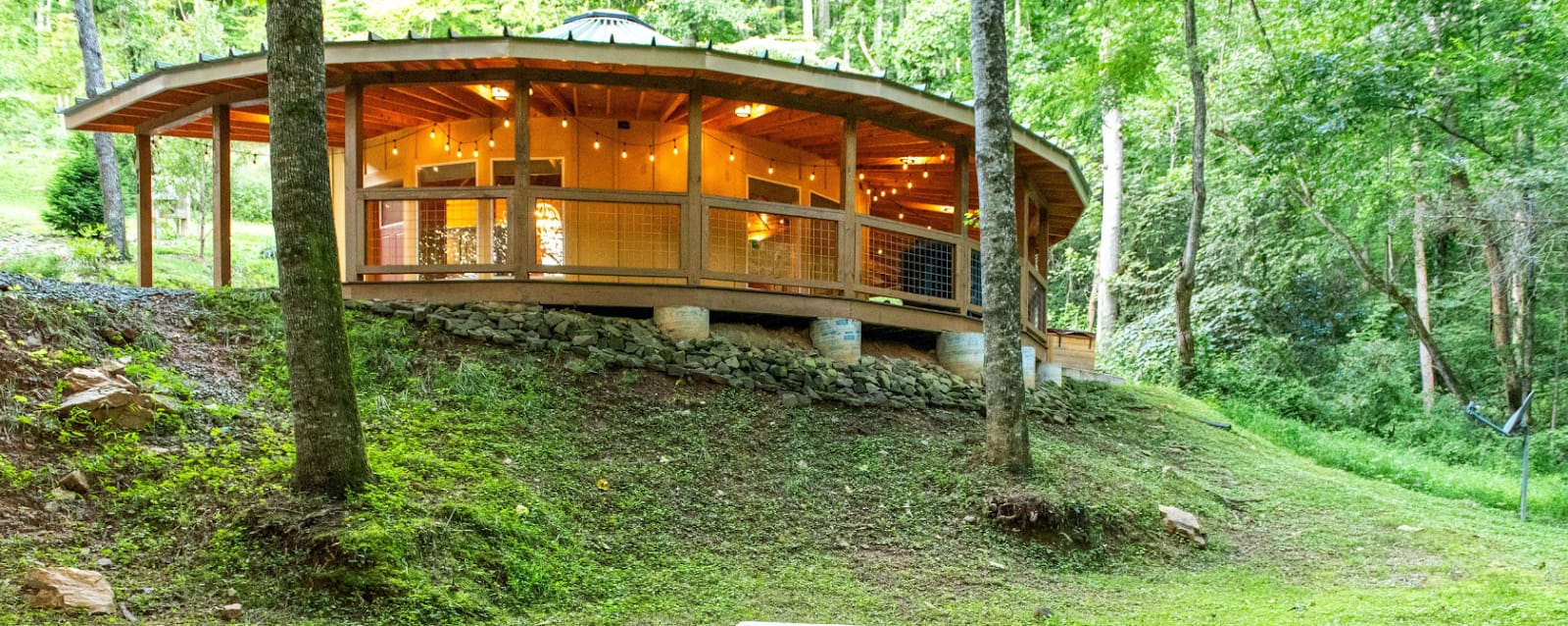
Elk Hollow Resort
Why stay here: Perfect for waterfall-chasing, glamping enthusiasts, families, and couples.
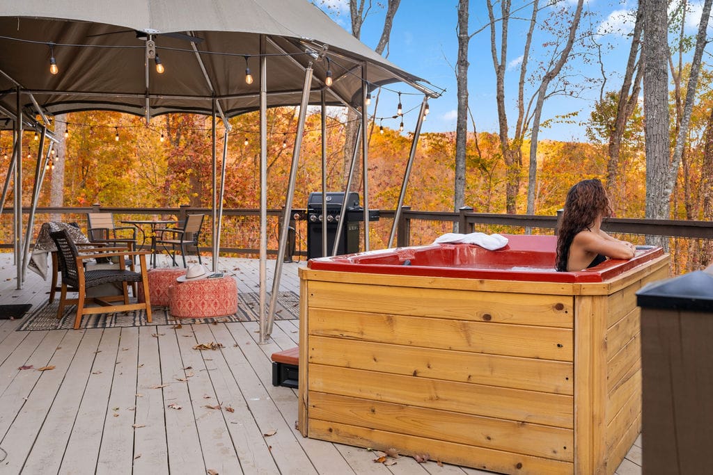
Enjoy private hot tubs to soothe sore legs after hiking, quick drives to Deep Creek and Fontana areas, and an unforgettable blend of comfort and nature.
Accommodation Options & Amenities
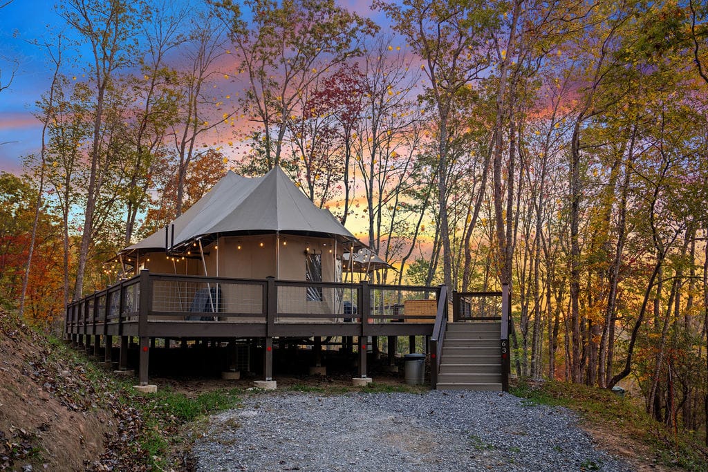
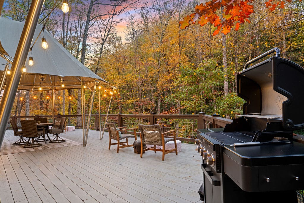
- South African Safari Tents
- Climate-controlled, king-size bed, full kitchen, private bathroom
- Spacious deck with gas grill, private hot tub & firepit
- Romantic string lights create magical nights
- Nestled in the mountains for ultimate luxury glamping
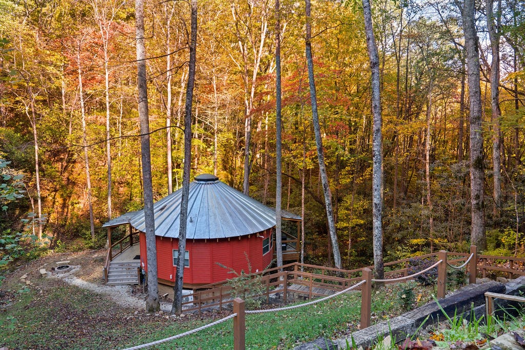
- Spicewood Luxury Glamping Yurts
- Hard-wall yurts with metal roofs
- Climate-controlled, king-size bed, full kitchen, private bathroom
- Spacious deck with gas grill, private hot tub & firepit
- Perfect for immersive mountain adventures
- Large Cabin Lodge
- 4 bedrooms, 4 bathrooms, large dining area, full kitchen
- Patio with sunset view, private hot tub & firepit
- Ideal for large groups or family stays
- Surrounded by serene mountain scenery
Guest Highlights:
- Spacious, fully stocked, and clean accommodations
- Impeccable attention to detail and welcoming hosts
- Great for families, couples, or group retreats
Book Your Stay at Elk Hollow Resort
Other Lodging Alternatives
- Downtown Bryson City hotels: Convenient for shops and dining, mid-range pricing
- Cabins: Private, scenic, suitable for families or groups; mid to splurge options
- Campgrounds: Budget-friendly, closer to trails, rustic outdoors experience
| Property | Type | Bedrooms/Beds | Bathrooms | Key Amenities | Ideal For | Notes |
| South African Safari Tent | Luxury Tent | 1 King | 1 | Climate control, full kitchen, private hot tub & firepit, deck with grill | Couples / Solo | Glamping experience, romantic setting |
| Spicewood Luxury Yurt | Luxury Yurt | 1 King | 1 | Climate control, full kitchen, private hot tub & firepit, deck with grill | Adventure seekers / Couples | Hard-wall structure, immersive mountain view |
| Large Cabin Lodge | Cabin | 4 | 4 | Full kitchen, large dining, hot tub, firepit, sunset patio | Families / Groups | Spacious, secluded, great for multi-family stays |
This setup makes Elk Hollow Resort the ultimate base for exploring Bryson City’s waterfalls, rivers, and trails while enjoying comfort, privacy, and style.
Check this out: Soco Falls Trail Guide 2025 | Uncover Nature’s Hidden Gem
Waterfall Photography Tips & Gear Guide
Capturing waterfalls is part art, part patience. The lighting, the angle, and yes, the gear all make a difference.
You don’t need a professional setup; your smartphone can do wonders if used smartly.
Camera & Lens Tips
- Smartphones: Use HDR mode and stabilize on rocks or a portable tripod
- DSLR / Mirrorless: Wide-angle lenses (16–35mm) for full frames; 24–70mm for flexible framing
- ND filters: Essential for silky water effects in bright daylight
- Polarizers: Reduce glare on wet rocks and enhance foliage color
Tripod & Stability
- Lightweight tripod for shaded falls and long exposures
- Bring a mini beanbag for uneven rocks if hiking light
Drone Photography
- Drones are not allowed in Great Smoky Mountains National Park (NPS rules).
- In national forests/state forests, rules vary—check the specific area before flying.
Quick Tips for the Best Shots
- Early morning or late afternoon offers soft, directional light
- Include surrounding elements, rocks, foliage, or foreground water pools for depth
- Experiment with angles: low to water, or high overlooks for scale
What to Pack for Waterfall Hikes Near Bryson City
Exploring waterfalls safely is half preparation, half awareness. Here’s what you should carry to keep the adventure smooth and safe.
Essentials to Pack
- Water (hydration is key)
- Traction shoes or hiking boots
- First-aid kit
- Layered clothing (weather can shift quickly)
- Dry bag for electronics
- Park permits / passes
- Bear-aware tips: bear spray, noise-making, storing food securely
- Snack bars or light trail food
- Hiking poles for moderate/steep trails
Packing Table: Short vs. Moderate Hikes
 2")
With these essentials in your pack, you’re ready to enjoy waterfalls safely, capture incredible shots, and stay comfortable on the trail.
You’ll be free to focus on the magic of cascading water without worrying about forgetting something critical.
Final Thoughts: Chasing the Best Waterfalls Near Bryson City
There’s something magical about standing beneath a waterfall, feeling the mist and hearing the rush of water.
From the easy roadside charm of Looking Glass Falls to the rewarding trek to Abrams Falls, each spot offers its own adventure and serenity.
Pack smart, plan your angles for photos, and enjoy the little joys along the trail, sunlight through the trees, fresh mountain air, or a quiet moment after the crowds.
Bryson City’s waterfalls promise wonder, adventure, and unforgettable memories; you just need to take that first step.
FAQs | Waterfalls Near Bryson City
1. Can I visit multiple waterfalls in a single day without rushing?
Yes, with careful planning. Start early, map driving routes efficiently, and prioritize falls by proximity. Some like Looking Glass Falls and Moore Cove Falls are close enough for a morning combo.
2. Are there waterfalls that are beginner-friendly but still scenic for photographers?
Absolutely. Moore Cove Falls and Graveyard Fields offer short, easy trails with picturesque views perfect for capturing long-exposure shots without a strenuous hike.
3. Which waterfalls have viewpoints that allow for behind-the-fall photography?
Moore Cove Falls allows you to walk behind the curtain of water safely. Always check footing and trail warnings, especially after rain.
4. Are any waterfalls wheelchair or stroller accessible?
Looking Glass Falls has a roadside pull-off and short paved path to view the falls. Other falls generally require moderate hiking.
5. When is the best time to photograph waterfalls with minimal crowd interference?
Early mornings and weekdays are ideal. Late spring offers full water flow and lush greenery, but summer weekdays can be surprisingly quiet.
6. Can I fish or kayak near these waterfalls?
Some areas near Fontana Lake and Bird Creek Falls allow kayaking or paddle sports, but most waterfall pools have restricted swimming or fishing for safety and conservation.
7. Are any waterfalls historically significant or culturally notable?
DuPont State Forest waterfalls have been filming locations for movies like The Hunger Games and Last of the Mohicans, adding cinematic appeal to your visit.
8. Are pets allowed on the trails?
Most trails in Pisgah and DuPont allow dogs on leashes, but Cades Cove has seasonal restrictions—check park rules before visiting.
9. How does water level affect photography and safety?
In spring and after rain, waterfalls are fuller, but currents are stronger. Summer may reduce flow but reveal rock formations and allow safer access for photos.
10. Are there hidden overlooks or unofficial trails worth exploring?
Some local photographers suggest small side paths at Graveyard Fields or DuPont Forest for unique angles, but always respect park signage and private property.